


Satellite images reveal drop in Chenab flow in Pakistan amid Indus treaty tensions
Updated: May 1st, 2025


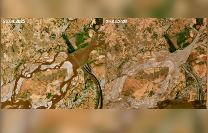
In what appears to be the first visible impact of India's suspension of the Indus Waters Treaty – announced in the wake of the Pahalgam terror attack – a satellite image circulating on social media has shown a reduction in the water flow of the Chenab River in Pakistan.
The treaty, established in 1960 and brokered by the World Bank, granted Pakistan unrestricted access to the western rivers (Indus, Jhelum, and Chenab), while limiting India to non-consumptive uses.
Despite wars and terrorist attacks, India had upheld the treaty for decades. Following the 2016 Uri attack, Prime Minister Narendra Modi suspended Indus Waters Treaty meetings while accelerating hydropower projects like Kishanganga. However, these actions remained within the treaty’s framework and did not have an immediate impact on Pakistan’s water supply.
Pakistan relies on rivers like the Chenab for over 80% of its agricultural output, as per reports. Any disruption in flow—whether in timing or quantity, even temporarily—could have devastating consequences for the country’s agrarian economy. Pakistan is already among the most water-stressed nations in the world.
As of now, there has been no official response from the Pakistani government regarding the satellite images showing reduced water flow.